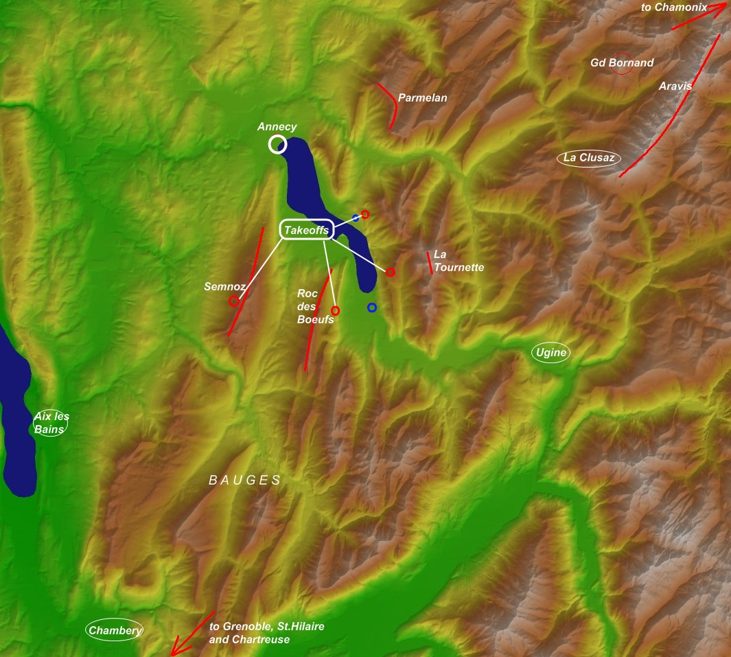
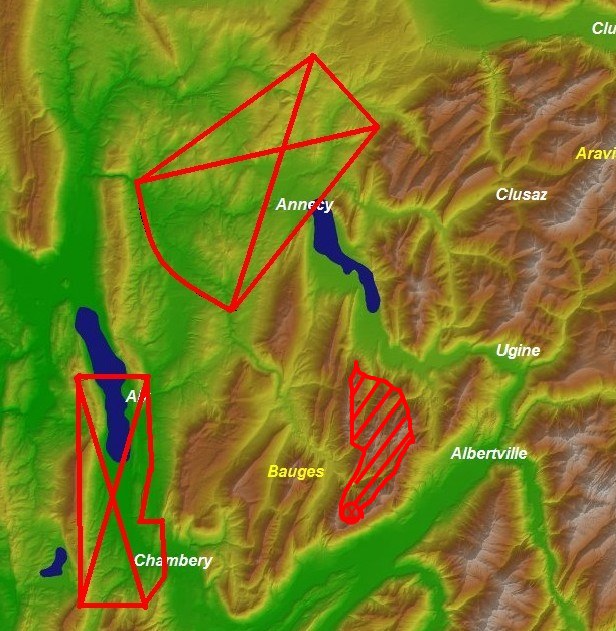
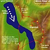
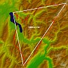
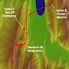
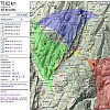
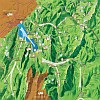
Annecy: Mini- "Tour du Lac"
The "Tour du Lac" is the classic tour that most visiting paragliders hope to do
if they have a little interest in flying Cross Country. On good days it should
be no problem to cross the lake even with an LTF-1 / EN-A glider. If you
are uncertain, just wait until you see a number of other pilots soar up on the
other side of the lake on the "Roc des Boeufs" ridge. You can reach the tip of
this ridge *very* low and still soar up.
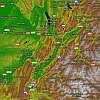
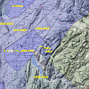
To come back, build up altitude on the ridge. If you are quite high and have a
good wing, it is not a challenge to go straight back to Forclaz, or even
Planfait. On a bad day, and if you are in doubt, use a trick: follow the ridge north using
it's
slightly lifting effect until you get more sink, then cross the lake with a slight turn
to the right towards Rovagny (aim for the prominent rocky spot
here). This minimizes the risk of having to fight against the valley wind,
which you might have when crossing too far south trying to reach Forclaz.
The Panorama while crossing the lake is breathtaking, check out the cool 360
degree VirtualReality
panorama of Tristan Shu |
Mini-Tour
Panorama360 |
|
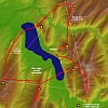
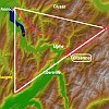
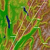
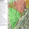
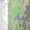
Annecy: "Tour du Lac Deluxe" - 50Km FAI
If you are a little more ambitious, the next step up is to include the
neighboring ridges Parmelan to the north and Semnoz to the west in the loop and
pay a visit to the highest mountain in the valley: "La Tournette"The crossing
to the Parmelan ridge is straightforward: collect as much altitude over the
"Dents de Lanfon" as possible and approach the corner that is in view. Try to
reach it with a little left-curve, as the valley-breeze causes a lee on the
right side.
You can reach the ridge low, and soar up. Note that the corner-thermal can be
quite turbulent on some days!
|
Tour
Deluxe
XC-Planner |
|
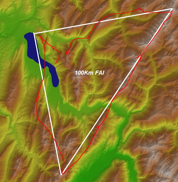
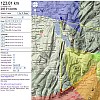
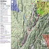
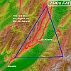
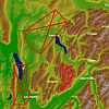
Annecy: 100Km FAI: Arclusaz / Pt.Percee
This 100Km FAI Triangle is the first step to leaving the "fish-bowl" around
Annecy:
- Cross over to the Roc de Boeuf
- turn around on the Dent de Arclusaz
- up to the Aravis
- and back home -> Flying over Thon against the valley wind can often be
a bit tricky: Learn from Tom's flight: Jump onto one of the 2 lower ridges
and soar up.
-
Flight example
1 and
Variant, both of Tom Payne on XContest
-
XC-Planner
|
100Km from Annecy
XC-Planner |
|
|
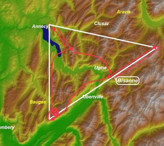
Bisanne 123Km FAI
This is a lesser know site, but the orientation to the SE and the ridge towards
Mont-Joly in the right exposure make it a good starting point.
|
XC-Planner
|
|
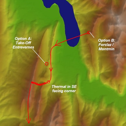
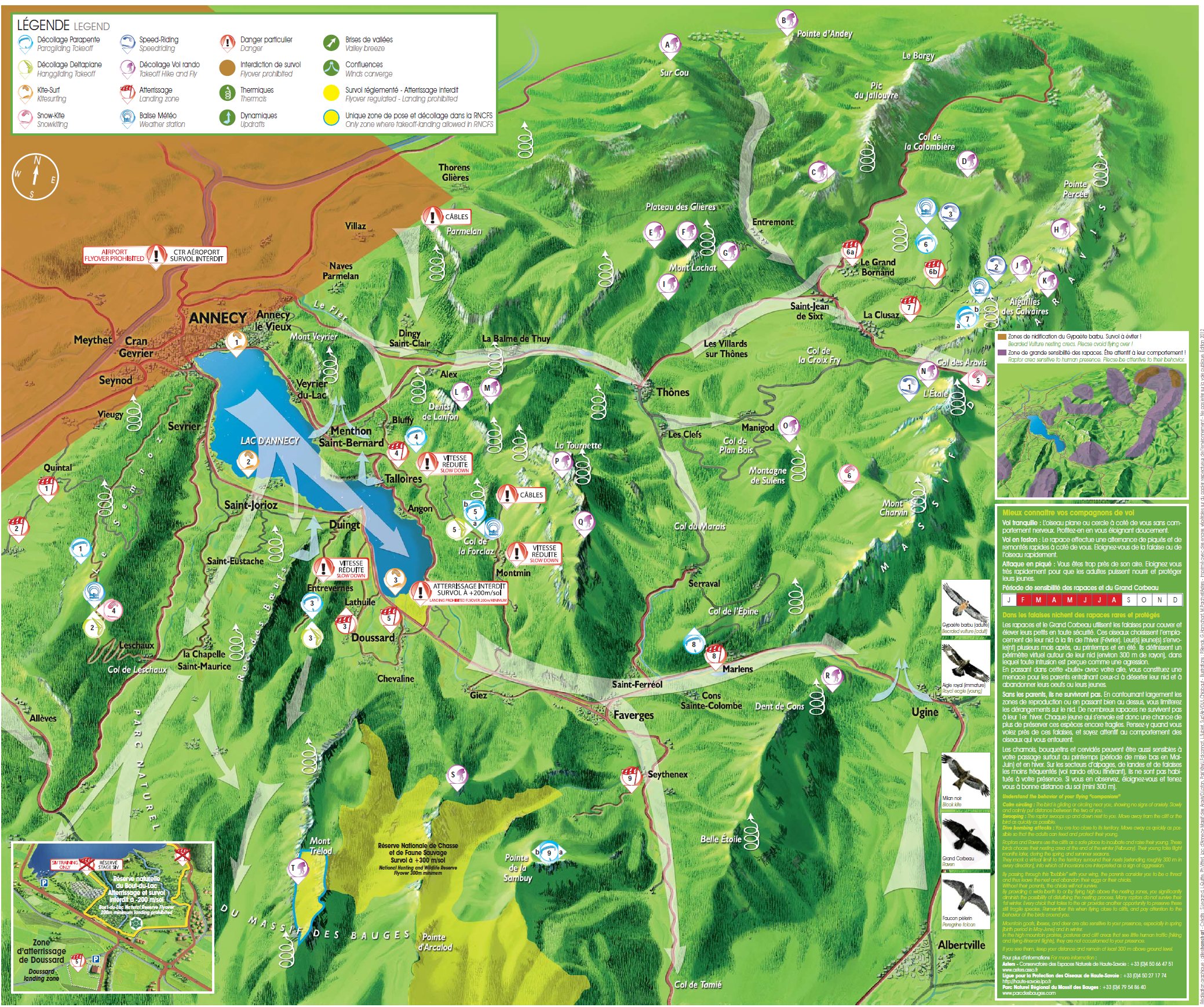
Starting early in AnnecyAs said above, the takeoffs facing NW are not ideal for early starts.
But the idea to get around this is simple: you can either start in
Entrevernes,
or cross the lake from Forclaz and thermal up on the Entrevernes ridge.
|
|
|
Meruz / Marlens: 230 Flat
This flight of Damien de Baenst is actually what brought me back to XC
flying after a break of 3 years where I focussed fully on competition flying. I
like this route, because it is straightforward and you get to see a lot of the
region:
-
Meruz is a private Take-Off of
Patrick Berod : Please do not
use it without his
explicit permission. You can probably find him in his
Auberge des Aravis in Marlens.
If you cannot reach him, you can use the official
takeoff in Marlens as an alternative. Meruz is better as it works even
earlier.
-
The route along the South-East facing ridge from Meruz down the Isere Valley
is ideal to get you going early in the morning.
-
Once you have been in Grenoble the sun is already a bit to the west, so you
have 2 sides that the Chartreuse ridge will be working on.
-
Crossing back near Chambery is easy with enough altitude, but the valley
wind from the north can make it tough when you are low: Gain as much alti as
possible before you cross.
-
The ridges in the Bauges up to Annecy are like a highway: I got an average
of 40Km/h over one hour up to the Parmelan ridge.
-
Now hurry to catch the last sunrays hitting the Aravis chain! If you are too
late, and there are no clouds over the Aravis you can also return via Annecy
and Tournette.
-
Flight of Damien: 215Km Flat
-
Waypoints in CompeGPS format
-
http://www.xcontest.org/2008/world/en/flights/detail:jaf/1.5.2008/08:08
-
XC-Planner
|
XC-Planner
|
|
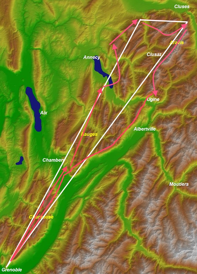
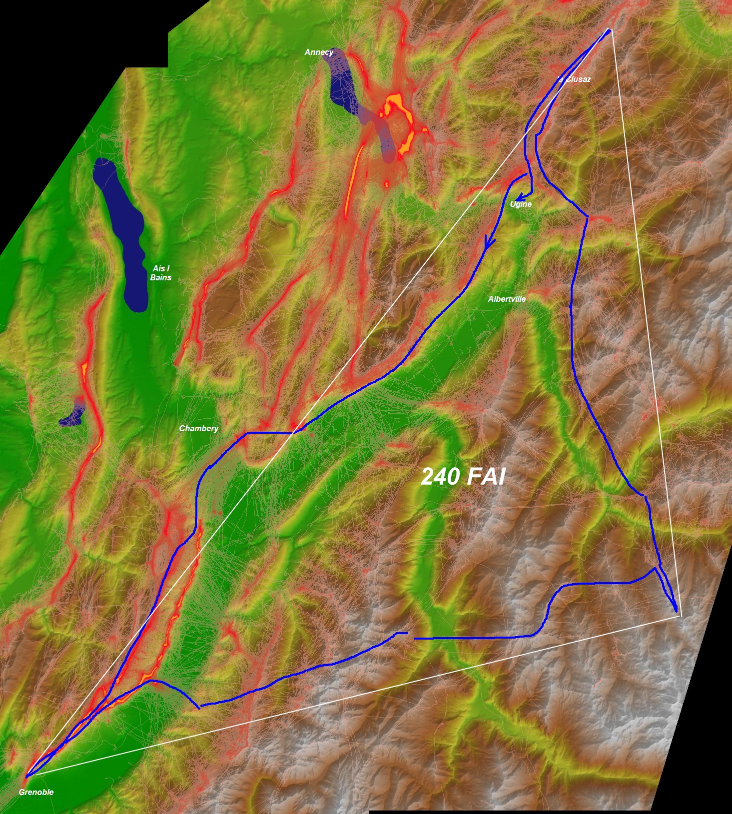
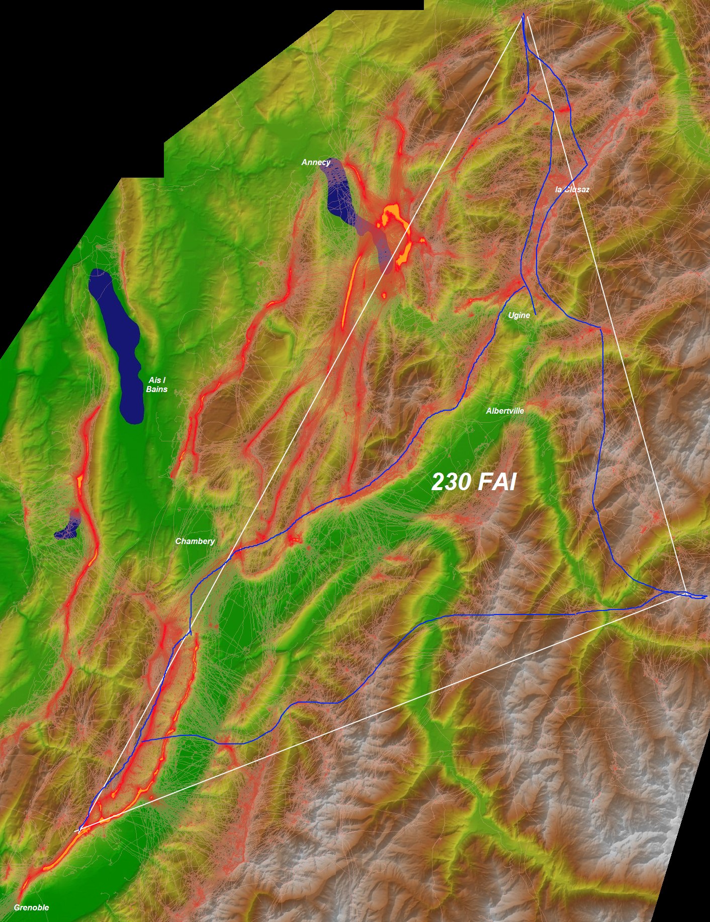
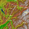
Ugine (Meruz): 230-260Km FAI
|
The following flights have not yet been done.
These projects are the biggest FAI-Triangles I can see as realistic for a fast pilot.
- The first part is again straightforward: south towards Grenoble.
- Then the 2 legs come that haven't been flown much so far.
I have drawn a suggested route into the pictures in the right, following the
Skyways-Tracks of flights that were already on the XC-Servers.
-
260Km in the XC-Planner
Variant 240Km
|
Topo 230Km
XC-Planner:260Km |
|
|
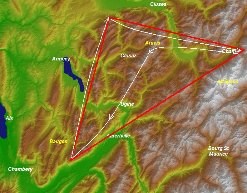
Chamonix - 180Km FAI
This flight is anenhanced version of the
170km "Pierre Boullioux Classic"
as Tom Payne has called it. "The limiting constraints are the 4000m+
mountain range behind Cham and the CTR vs geneva. This more or less
fixes the lower turnpoint in a very exact spot on the Dent d'Arclusaz.
Toms
flight in
Leonardo
The detailed
discussion in the PG-Forum about this flight,
with all the
details, pictures etc.
|
XC-PLanner
|
|
St Hilare: 75km FAI
"Lunchtime Flight"
|
This is the classic FAI Triangle that you can fly from
St. Hilaire on an avrage day:
- Down to Grenoble and up the Aravis chain
- up on the other side
- and back home.
-
XC-Planner
|
Overview w Skyways
XC-Planner
|
|
|
Serpaton 260Km Flat
|
|
A great flight from Guy Parat.
|
Overview
XC-Planner
|
|
|
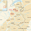
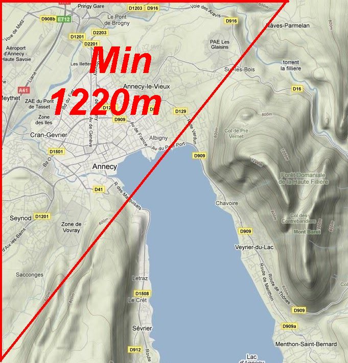
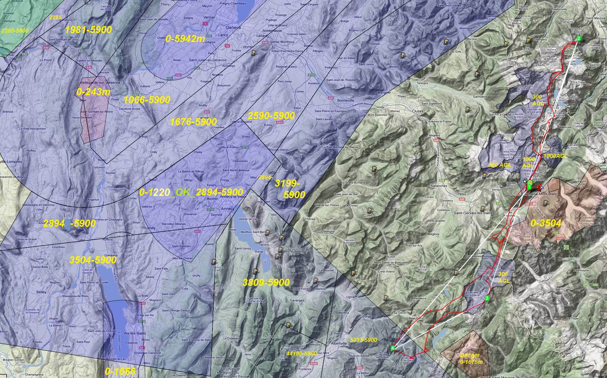
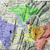
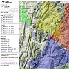
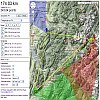
Airspaces
|
NOTE: All the information on this page is outdated (Created in 2010, not much updated!)
Overall not that much changed, but there can be slight differences. e.g. the Annecy Airport raised it's upper ceiling to 1220m
The Airspaces are luckily normally not a big issue in Annecy and the region:
They are nicely aligned in the flatland so that the mountains can be flown
without much problem. Just be careful when you cross towards Semnoz that you
don't fly over the city too much as downtown is already in the CTR.There is a
No-Fly zone on the east side of the Bauges National Park as you can see in the
official overview document. Just stay off the plateau there
(here in the forum are
more detailed pictures)
Here you
can download the restricted areas for your GPS or to view them in GE:
|
SIMPLE Overview
Tourist Office
PDF

Detail: Annecy City
More detailed Overview
|
|
|